
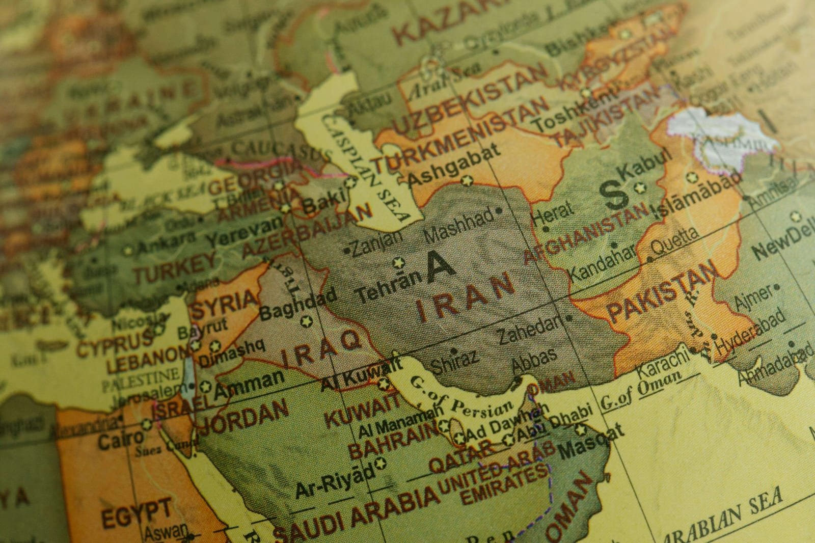
Pakistan sits at a very important point on the map of Asia. It connects South Asia with Central Asia, the Middle East, and Western China. Because of this location, the region has been a meeting point for trade routes, cultures, and political movements for centuries. Today, Pakistan continues to hold strategic value not only for its neighbors but also for global economic and security interests.
With an area of about 881,913 square kilometers, it is the 33rd largest country in the world. The country shares borders with India to the east, Afghanistan to the northwest, Iran to the southwest, and China to the north. To the south lies the Arabian Sea, which gives it direct access to international maritime trade routes. This position places Pakistan between several major regions, making it an important bridge between different parts of Asia.
Geography often shapes the political and economic importance of a country. In Pakistan’s case, its location has influenced trade, security, regional cooperation, and cultural exchange for hundreds of years.
Pakistan as a Crossroads Between Regions
Pakistan’s geographical position places it at the center of several important regional connections. South Asia, Central Asia, the Middle East, and East Asia are all within close reach. Because of this, the country has historically served as a passage for merchants, travelers, scholars, and even invading armies.
For example, ancient trade routes such as the Silk Road connected parts of Central Asia and China to South Asia through areas that now fall within its borders. These routes allowed goods such as silk, spices, textiles, and precious stones to move between distant civilizations. At the same time, ideas, languages, and traditions also traveled along these paths.
Even today, its location allows it to act as a corridor between landlocked Central Asian countries and global markets. As these nations look for access to warm water ports, Pakistan’s southern coastline becomes especially valuable. Therefore, geography continues to influence economic opportunities and regional partnerships.
Access of Pakistan to the Arabian Sea
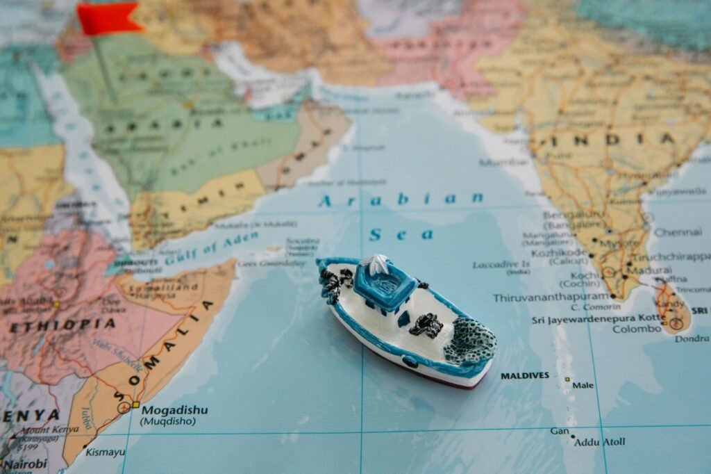
One of Pakistan’s most significant geographic advantages is its coastline along the Arabian Sea, which stretches for nearly 1,046 kilometers. This coastline connects the country directly to important maritime trade routes used by ships traveling between the Middle East, Africa, and Asia.
Major ports such as Karachi Port, Port Qasim, and Gwadar Port play an important role in handling trade for the country. Karachi has long served as its primary commercial port, while Gwadar has gained attention in recent years because of its potential to become a major regional trade hub.

Gwadar’s location near the Strait of Hormuz, one of the world’s busiest oil shipping routes, makes it strategically significant. A large percentage of global energy supplies pass through this narrow waterway. As a result, countries around the world closely watch developments in this region.
Access to the sea also supports its trade with international markets. Goods such as textiles, rice, and manufactured products move through these ports, connecting Pakistan’s economy with the wider world.
Natural Landscapes and Geographic Diversity
Pakistan’s geography is not only important for its location but also for its natural diversity. The country contains some of the most varied landscapes in Asia.
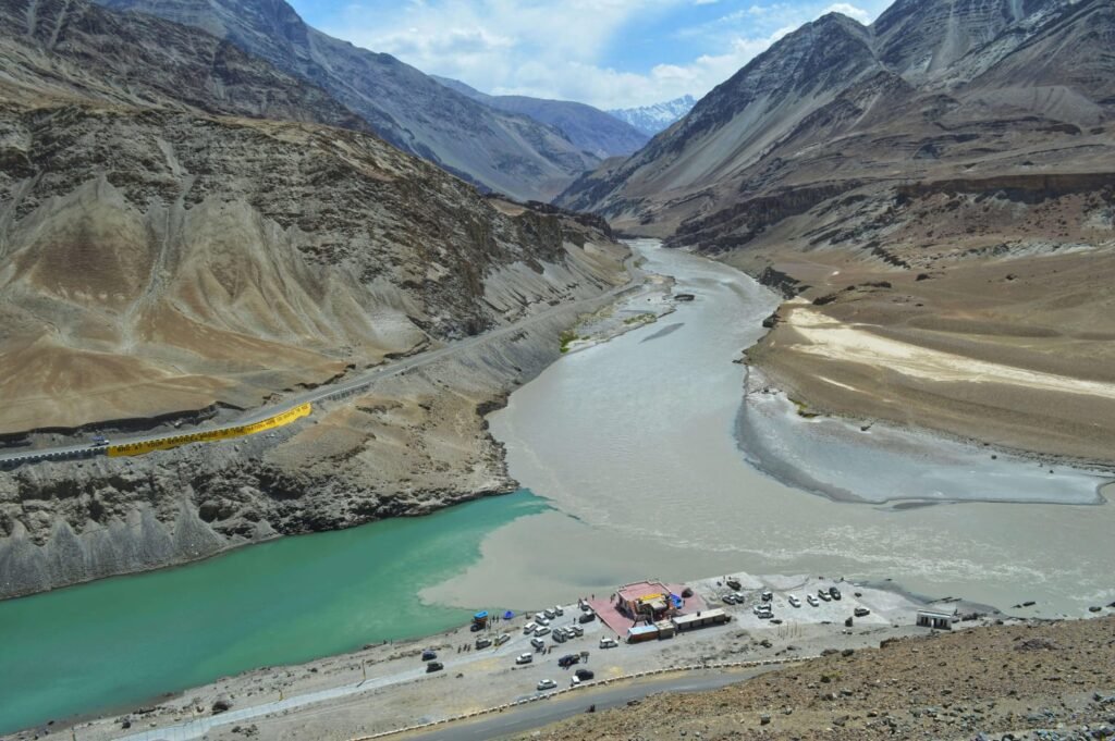
In the north, the towering mountain ranges of the Himalayas, Karakoram, and Hindu Kush form one of the most dramatic high altitude regions on earth. These mountains include K2, the second highest peak in the world. Apart from their beauty, these mountains influence climate patterns and serve as important sources of water through glaciers.

Moving southward, the Indus River flows through the country from north to south. The Indus basin supports agriculture across large parts of Pakistan. As a result, many of the country’s major cities and farming regions developed along this river system.
Further south and west, the landscape gradually changes into deserts and coastal plains. The Thar Desert in Sindh and the dry plateaus of Balochistan show how varied its terrain truly is. Because of these geographic features, it supports different climates, ecosystems, and economic activities across its provinces.
Strategic Importance in Modern Times
Pakistan’s geographical position has also shaped its role in modern regional politics and economics. Located near several key regions, the country often becomes part of broader discussions about trade routes, security cooperation, and regional connectivity.
One example is the China Pakistan Economic Corridor, commonly known as CPEC. This large infrastructure project connects western China to Pakistan’s Gwadar Port through a network of roads, railways, and energy projects. The idea behind this corridor is to create a faster trade route that links inland Chinese regions with global markets through the Arabian Sea.
Because Pakistan lies between major economic regions, projects like these attract international attention. Countries interested in trade access, energy transport, and regional stability often view it as an important partner.
At the same time, the country’s borders with Afghanistan, Iran, China, and India place it in a complex political neighborhood. As a result, geography continues to influence both cooperation and challenges in the region.
Geography and Cultural Exchange
Location does not only affect politics and trade. It also shapes culture. Over centuries, people moving through this region brought different languages, traditions, and artistic styles.
For example, many ancient civilizations developed in areas that are now part of Pakistan. The Indus Valley Civilization, one of the earliest urban societies in the world, existed here thousands of years ago. Later, the region saw the arrival of Persian, Greek, Central Asian, and Mughal influences.
Because Pakistan stood along important travel and trade routes, cultural exchange became part of everyday life. Food, clothing, architecture, and languages across the country reflect this long history of interaction between different civilizations. Even today, the country’s culture shows traces of these historical connections.
Conclusion
Pakistan’s geographical location has shaped its story for centuries. Positioned between South Asia, Central Asia, China, and the Middle East, the country naturally became a meeting point for trade, cultures, and ideas. Its access to the Arabian Sea strengthens its role in international commerce, while its borders connect it to several important regions of Asia.
At the same time, its mountains, rivers, deserts, and coastline create a landscape that is both diverse and influential in shaping economic and social life. Geography does not only define a country’s physical boundaries. It also influences how that country interacts with the world.
For Pakistan, location has always been more than just a point on the map. It has been a gateway that links different regions, histories, and opportunities together.


